|
Introduction
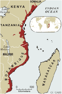
The coastal forests of eastern Africa extend from Kenya and Tanzania and into Mozambique, as far south as Maputo. The southern portion of the coastal forest habitat forms the major part of the Southern Zanzibar-Inhambane coastal forest mosaic ecoregion, which is regarded as a global priority for conservation by WWF and Conservation International. At least 4,180 sq. km of coastal forest and related habitats types are found in Mozambique, although the forest areas have not been mapped in detail.
Biological Importance
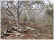
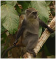
 The biological importance of the coastal forests in Mozambique is not well known. To date the only endemic animal species are known from the Bazaruto Archipelago in the far south, and there is an endemic tree in the northern part of Mozambique. However, the forests are extremely poorly known and there are likely to be many additional endemics once inventories have been carried out. The biological importance of the coastal forests in Mozambique is not well known. To date the only endemic animal species are known from the Bazaruto Archipelago in the far south, and there is an endemic tree in the northern part of Mozambique. However, the forests are extremely poorly known and there are likely to be many additional endemics once inventories have been carried out.
Promising areas for discovering additional endemic and rare animals and plants are the forests on the Mueda Plateau in the far north of the country. Plant species previously believed to be confined to southern Tanzania have been found in this area. Also promising are the forest patches associated with the numerous inselbergs in coastal Mozambique in the north, and the denser coastal forest patches that are scattered along the coast close to the ocean.
Protective Status of Coastal Forests
The coastal forest habitats of Mozambique are protected in the Quirimbas National Park and in five of the 13 Forest Reserves in the country (Baixo Pinda, Derre, Inhamitanga, Matibane and Nhampacue). These are administered by the National Directorate of Forest and Wildlife (DNFFB) within the Ministry of Agriculture. Additional areas of similar coastal dune forest habitats are also found in the Bazaruto National Park to the south.
Back to top
From north to south, areas of protected coastal forest occur as follows;
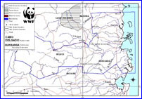
Cabo Delgado Province
Name: Quirimbas National Park
 Description:
Miombo woodlands, coastal forests and thickets with smaller areas of wet forest existing at the base of inselbergs. Altitude 0 - 200m asl along the coast, reaching 600 m asl at the interior. Hot and dry coastal plain with annual rainfall of 900 mm. Also areas of mangrove, coral reefs and seagrass beds. Few biological studies have been completed. Description:
Miombo woodlands, coastal forests and thickets with smaller areas of wet forest existing at the base of inselbergs. Altitude 0 - 200m asl along the coast, reaching 600 m asl at the interior. Hot and dry coastal plain with annual rainfall of 900 mm. Also areas of mangrove, coral reefs and seagrass beds. Few biological studies have been completed.
Location: 12 ° 00’00” S - 12 ° 55’04” S; and 39 ° 10’00” E - 40 ° 39’44” E
Area: Total area: 7,506 sq. km. 5,984 sq. km are terrestrial. 2,122 sq. km are coast line and marine.
Conservation: Government departments including the National Directorate of Conservation Areas of the Tourism Ministry; Fishing Department and Forest Department contribute to the management of the Quirimbas National Park. NGO’s including WWF and IUCN are also present.
Back to top
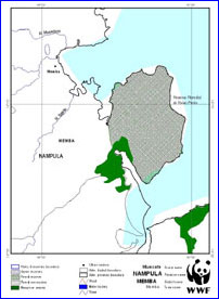 Nampula Province Nampula Province
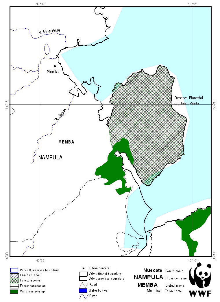
Name: Baixo Pinda Forest Reserve
Description: Altitude 0 - 120 m asl. Marine sand soil is of low fertility
Location:
14º13’ S;
40º42’ E
Area: 20 263 ha (National Directorate of Forest and Wildlife (DNFFB), 2005 GIS data)
Conservation: An area of 19,600 ha was gazetted in 1957, predominantly for the protection and recovery of Androstachys johnsonii. Since this time there has been considerable encroachment, with severe clearance for agriculture. The reserve is managed by the National Directorate of Land and Forestry. The marine resources are managed by the Fishing Ministry.
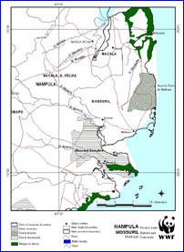 Name: Matibane Forest Reserve Name: Matibane Forest Reserve
Description: Altitude 0 -120 m asl.
The Reserve includes areas of marine sand soil, alluvial soil and coastal dunes, of significant salinity. An area of approximately 4,200 ha is covered by Androstachys johnsonii.
The diversity of the fauna is low, with 21 species of small mammal, few large mammals and 40 species of birds.
Location:
14º36’ S - 40º48’ E
Area: 11 109 ha (National Directorate of Forest and Wildlife (DNFFB), 2005 GIS data).
Conservation: The reserve was gazetted in 1957. It is managed by the National Directorate of Land and Forestry. The marine resources are managed by the Fishing Ministry.
Back to top
 Zambézia Province Zambézia Province
Name: Derre Forest Reserve
Description: Predominant species Brachystegia spiciformis.
Location:
17º00’ S - 36 º00’ E
Area: 158 290 ha (National Directorate of Forest and Wildlife (DNFFB), 2005 GIS data).
Conservation: The reserve was gazetted in 1957. It is managed by the National Directorate of Land and Forestry. The marine resources are managed by the Fishing Ministry.
Back to top
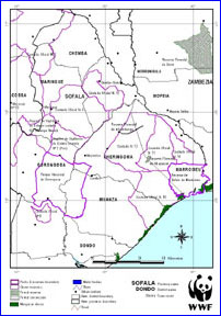
Sofala Province
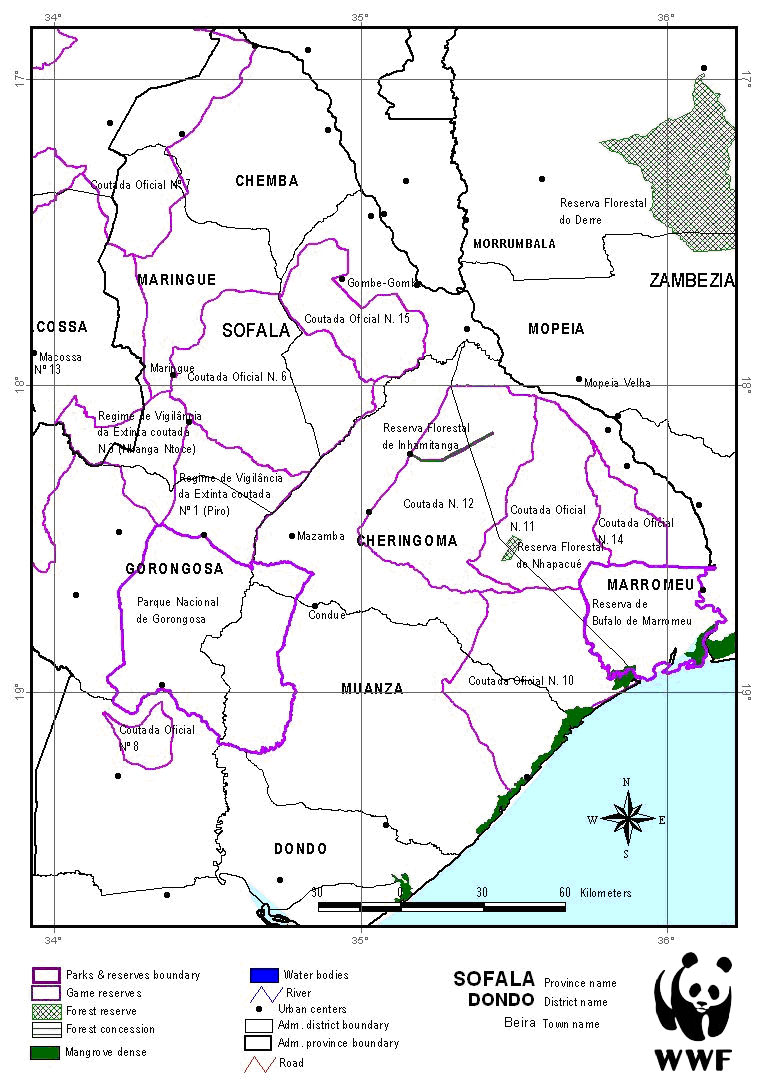
Name: Inhamitanga Forest Reserve
Description: Areas of
evergreen forest commonly host Celtis mildbraedii and Drypetes gerrardii. Dry deciduous forest areas commonly host Millettia stuhlmannii. Soils are mostly sandy, turning to clays in natural grassland areas.
Location:
18˚10' S; 35˚2' E
Area: 1 704 ha (National Directorate of Forest and Wildlife (DNFFB), 2005 GIS data).
Conservation: The Reserve was gazetted in 1957. It is managed by the National Directorate of Land and Forestry.
Name: Nampacué Forest Reserve
Description: Predominantly miombo woodland dominated by Brachystegia spiciformis. The Reserve contains areas of evergreen forest and protects the transition from undifferentiated coastal forest to Zambezi inundated grasslands.
Location: 18˚30’ S - 35˚37’ E
Area: 2 620 ha (National Directorate of Forest and Wildlife (DNFFB), 2005 GIS data).
Conservation: The Reserve was gazetted in 1957. It is managed by the National Directorate of Land and Forestry. There are Game Reserves around the Forest Reserve, in addition to Marromeu National Park. The Game Reserves aim to protect buffalo.
Back to top
Publications
Albano, G. (2004). Coastal Forests of Mozambique. Socio-economic Aspects - Review. WWF Eastern Africa Regional Programme Office. (pdf) 22 pp.
Fátima Kanji, F., Albano, G., Macucule, A., Soto, S., and Massango, H. (year unknown). The Coastal Forest of Mozambique. WWF Eastern Africa Regional Programme Office. (pdf) 32 pp.
IIAM, 2008. Expedition Report: "Reconnaissance of Coastal Forests in Cabo Delgado. (pdf) pp. 43
Macucule, A. (year unknown). Consultancy Report of National and Regional Trade of Flora and Fauna. WWF Eastern Africa Regional Programme Office. (pdf) 32 pp.
Mackenzie, K. (2006). Forest Governance in Zambezia, Mozambique. Prepared for FONGZA. (pdf) 96 pp.
Massango, H., A. (2004). National Review on Enabling Environment (Laws and Polices). WWF Eastern Africa Coastal Forests Ecoregion Progromme. (pdf) 23 pp.
Müller,T., Sitoe, A., and Mabunda, R. (2005). Assessment of the Forest Reserve Network in Mozambique. On behalf of WWF Mozambique Coordination Office. (pdf) 56 pp.
ProForest Ltd (year unknown). Use of the HCV framework in Mozambique; A summary of workshop outputs. (pdf) 18 pp.
Sitoe, A., Mabunda, R., Belokurov, A., Ntumi, C., Fusari, A., Couto, M., Silveira, S., Foloma, M., and Lichuge J. (2006). On behalf of WWF EARPO. Rapid and Participatory Assessment of Management of the Conservation Areas in Mozambique. (pdf) 57 pp.
Soto, S., J. (2007). National Assessment of Coastal Forests Resources (Mozambique). WWF Eastern Africa Coastal Forests Ecoregion Progromme. (pdf) 23 pp.
Timberlake, J. D. Goyder, F. Crawford, J. Burrows, G. P. Clarke, Q. Luke, H. Matimele, T. Muller, O. Pascal, C. de Sousa and T. Alves. 2011 Coastal dry forests in northern Mozambique. Plant Ecology and Evolution 144 (2): 126 - 137.
Back to top
Links
Clarke, G.P. (2010) Report on a reconnaissance visit to Lupangua Hill, Quissanga District, Cabo Delgado Province, Mozambique, with notes about Micklethwaitia carvalhoi. 20pp. (12.5 Mb pdf document)
Clarke, G.P. (2011) Observations on the Vegetation and Ecology of Palma and Nangade Districts, Cabo Delgado Province, Mozambique. 130 pp. (45 Mb pdf document)
Back to top
|